Page 1 of 1

Dutch Coastline

Posted: Fri Aug 31, 2012 10:05 am
by Erik Springelkamp
Although it is mostly outside the playing area of the current scenario's, I would like to point out that the coastline of the Netherlands at the time was quite different from that of today, and the way it is depicted in the map.

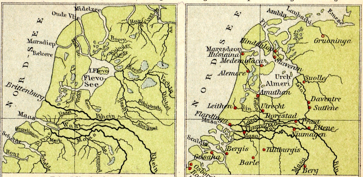
Especially the coast of Zeeland, in the South-West corner didn't consist of islands, but the dunes still formed a continuous line. Human exploitation of the peat behind the dunes - for salt production - was one of the reasons of the breaking in of the sea during the Middle Ages.

http://en.wikipedia.org/wiki/Rhine%E2%80%93Meuse%E2%80%93Scheldt_delta

Image

Image

Posted: Fri Aug 31, 2012 6:44 pm
by FENRIS
Wonderful land Holland :love: right ! the coast had change a lot !

:wavey:

Posted: Sat Sep 01, 2012 11:09 am
by Pocus
Very interesting informations!

Posted: Sat Sep 01, 2012 1:14 pm
by Erik Springelkamp
I also think that the names of three areas North of the Rhine are shuffled:

- Trajectum: in this region (there were many more places named Trajectum, which just means 'ford', the closest being Maastricht) is Utrecht, which is in the game region named Frisii. This Utrecht Trajectum was just one of the fortresses of the later Roman limes here.

- Frisii: one certain location where Frisii lived is around Velsen (and North of it), on the coast directly West of current Amsterdam, because there is a narrative about a revolt there, and the siege of the Roman camp there has been found archeologically. That area is in the game called Caninefates.

- Caninefates: lived in the neighbourhood of current the Hague, where the Romans constructed their capital Forum Hadriani. This area is in the game called Trajectum.
http://en.wikipedia.org/wiki/Forum_Hadriani

- Fectio: was a limes fortress just South of Utrecht.

Frisii in Roman times were described as living West of the Chaucii, while Chaucii were described as living from the mouth of the Ems (Amisia) to the East and the South. So the area called Chaucii in the game seems to me to be too far to the West. That area is supposed to be Frisian.

Placing the area Batavii South of the river Mosa is also strange: the core land of the Batavii was North of and including Nijmegen, where the 'Island of the Batavii' was between the river Waal (Vahalis) and the Lower Rhine, that is not depicted on this map, but that ran along Fectio, Trajectum, towards the mouth at Katwijk (Brittenburg in the map in the OP), and maybe further along the Rhine towards Colonia Agrippina.

Posted: Sat Sep 01, 2012 1:27 pm
by yellow ribbon
1.) for the purpose that nothing gets lost, i took the liberty to link between the thread and the beta-test forum...

2.) for the river i might explain this, its coming from the fact that in AGEOD games the rivers are alway on the border between provinces.
its not geographical correct, in Spain there was another issue reported from the forum, but running it as a real life map, one would need to shuffle many more provinces the same time...
thus the emphasis is on provinces (at all), tribes living there, towns fitting to the rough area or exact name of the province and only then, but then, the river comes close by in AGEOD maps

PS:

groetjes uit vlaanderen :wacko: