real map to match
Posted: Thu Mar 11, 2010 6:07 am
by mjw
I am somewhat unfamiliar with the geography of central europe and none of the map filters really seem to properly orient me. Can anyone recommend a website or provide a link or something to a map of this area that I can print out to help...preferably a map drawn according to 7 yrs war period geography.
Posted: Thu Mar 11, 2010 9:31 am
by PANGI
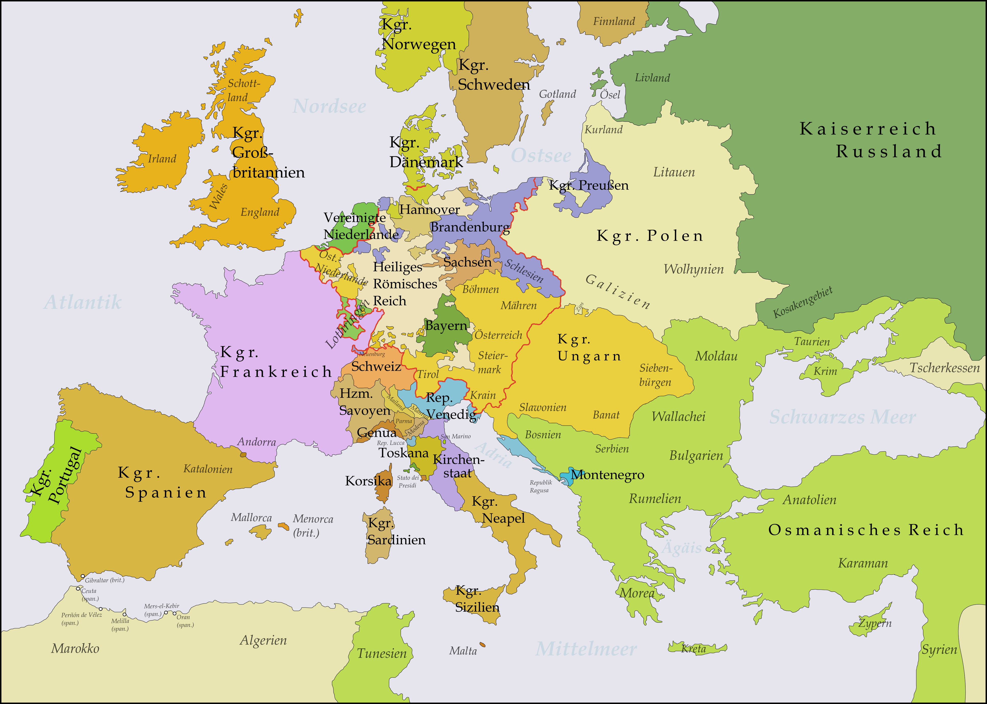
You mean geography? I think you dont need 18c map for it but if you are interested in political setup -> 1789 map of HRE - with some minor correction you can find out about 1756 borders in this area
http://www.hoeckmann.de/germany/index.htm
Posted: Thu Mar 11, 2010 11:33 am
by Nikel
There are some maps on the SYW, West Point or USMA Atlas, browse to the botton of the page
http://www.dean.usma.edu/history/web03/atlases/dawn_modern_warfare/index.htm
General overwiew
[img]http://www.nipissingu.ca/faculty/coryf/HIST2506/resources/Seven%20Years'%20War%20[World%20Map].jpg[/img]
Posted: Thu Mar 11, 2010 2:29 pm
by mjw
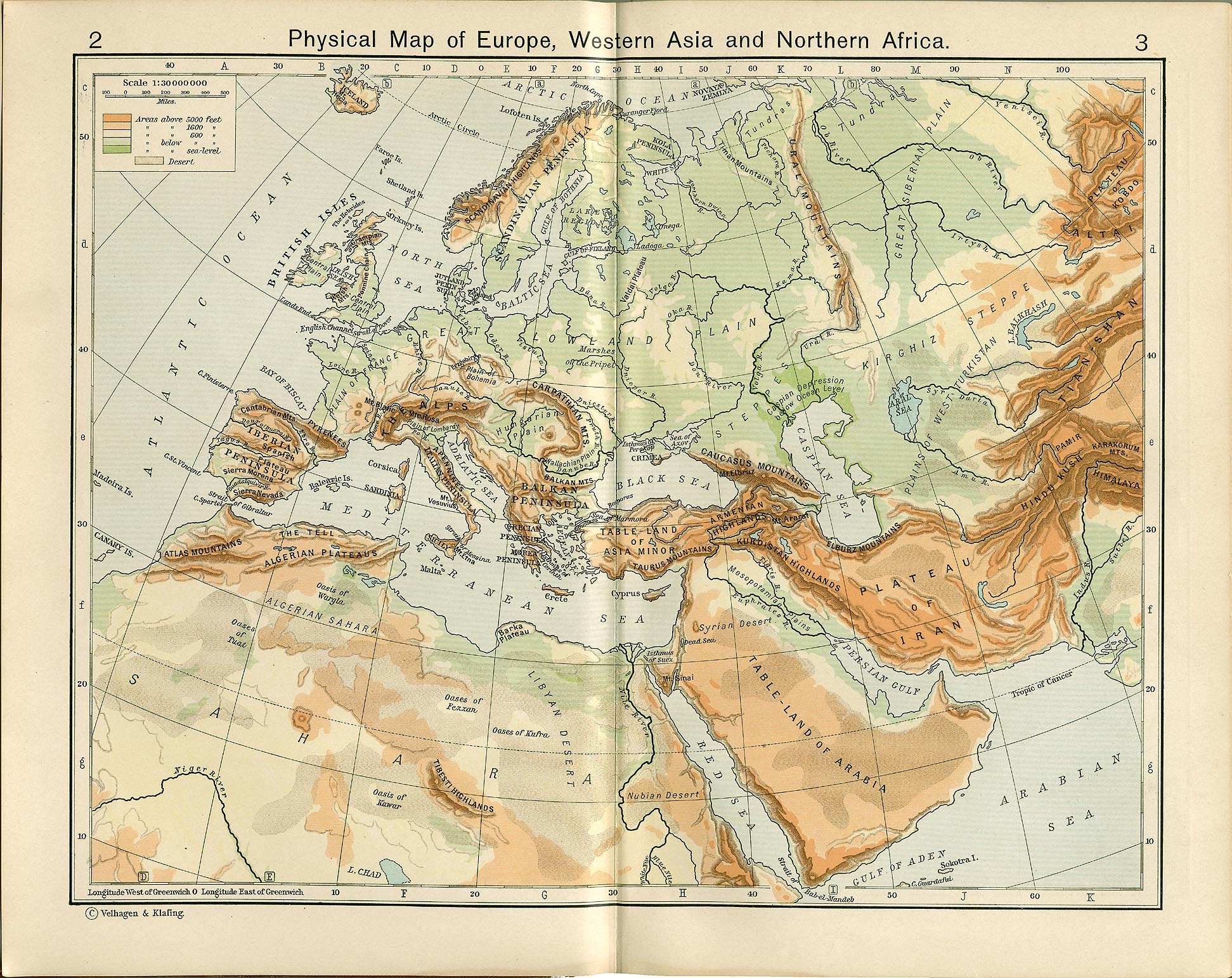
Yes, geography. I want to see where the rivers,mountains and towns are located... But mainly, as you corrected me, the political boundaries. I want to see the boundaries of Poland, Hesse,hannover etc. I think these maps will work as I just want to have one next to me while I play for quick reference.
Thanks for the links guys
Posted: Thu Mar 11, 2010 7:37 pm
by Syt