Page 1 of 1

Italy, (Geopolitic)

Posted: Thu Dec 11, 2008 12:36 pm
by jastaV
Image

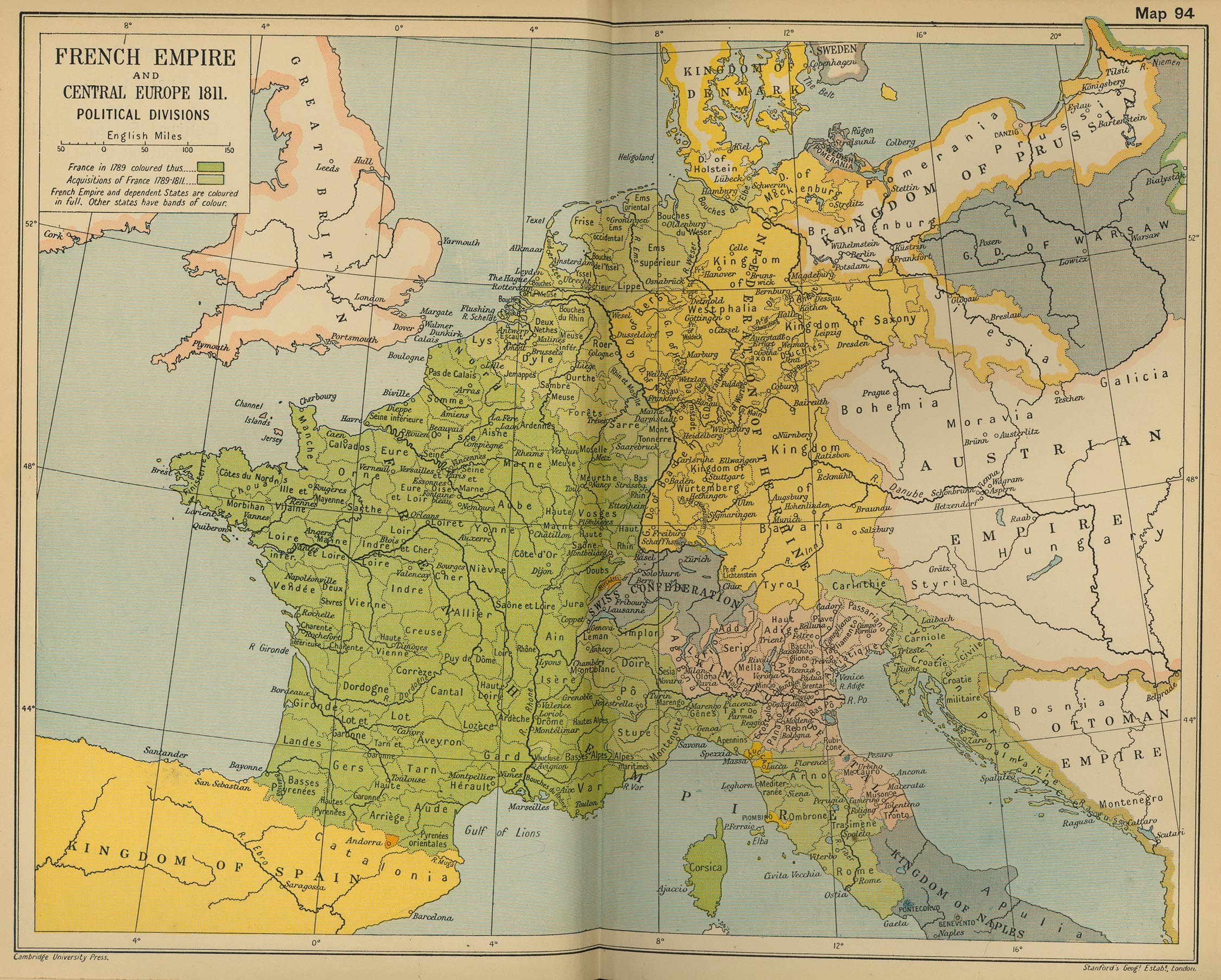
Here a picture of the Geopolitic map of Italy, 1808-1813.
AS reproted by Murat, Indipendent State of Tuscany and Pontifician States, figure out in many scenarios: 1813 as an example.
A thing to be fixed!

Big thank to Murat for reporting! :neener:

Posted: Thu Dec 11, 2008 6:26 pm
by FM WarB
The borders changed after Napoleon's victory in 1809. Would merely changing loyalty of certain provinces do the trick?

Posted: Thu Dec 11, 2008 10:50 pm
by jastaV
FM WarB wrote:The borders changed after Napoleon's victory in 1809. Would merely changing loyalty of certain provinces do the trick?


You can change loyalty, editing cities.inc file, or you can change the political map editing subfactions.inc file.
Anyway you'll have then to Edit Mode process Scrips file to get the SCN file for that scenario! :wacko:
Guess the two way are equivalent in term of time and efforts. :cool:

Posted: Fri Dec 12, 2008 10:40 am
by Comtedemeighan
Image

Posted: Fri Dec 12, 2008 11:34 am
by jastaV
Great map, thank!